Thursday, July 28, 2011

Farewell Canada, Hello America

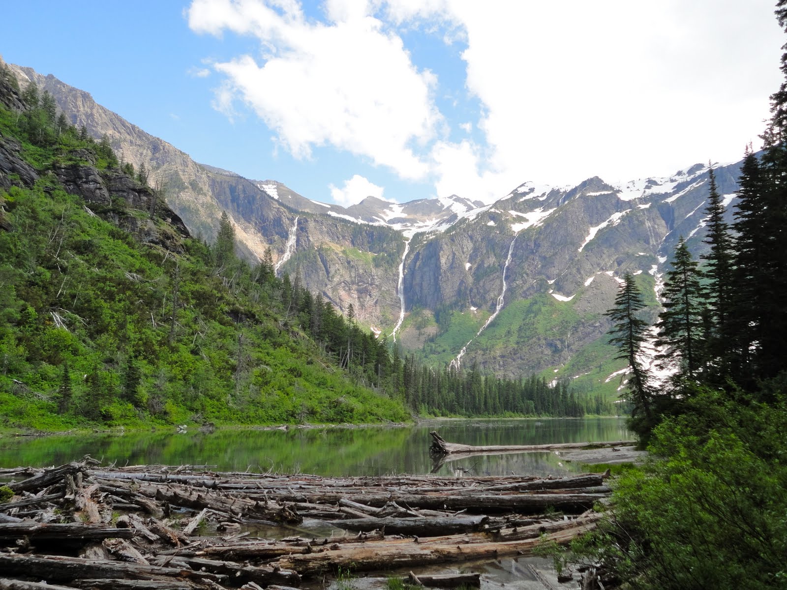
Heading west, towards Whistler (where the 2010 Winter Olympic Games were held), we took a few detours and decided to stop and hike Canada's "boardwalk trails" that are highlighted along the highway - two ancient forests, and a unique mountain wetland path...with a grizzly bear warning in the entrance way. 
An ancient forest along the highway. Canada is doing its part to preserve natural wonder.
Mark was completely unfazed by this. I was having heart palpitations.
The forests were lush with layers of plant-life. Beautiful.
That night, we stayed at a campsite that was a glorified parking lot along the highway, but a redeeming quality is that next door there was an animal sanctuary for frail, old, and injured animals. We saw bald eagles, coyotes, bobcats, owls, elk, wolves and yes...a grizzly bear.

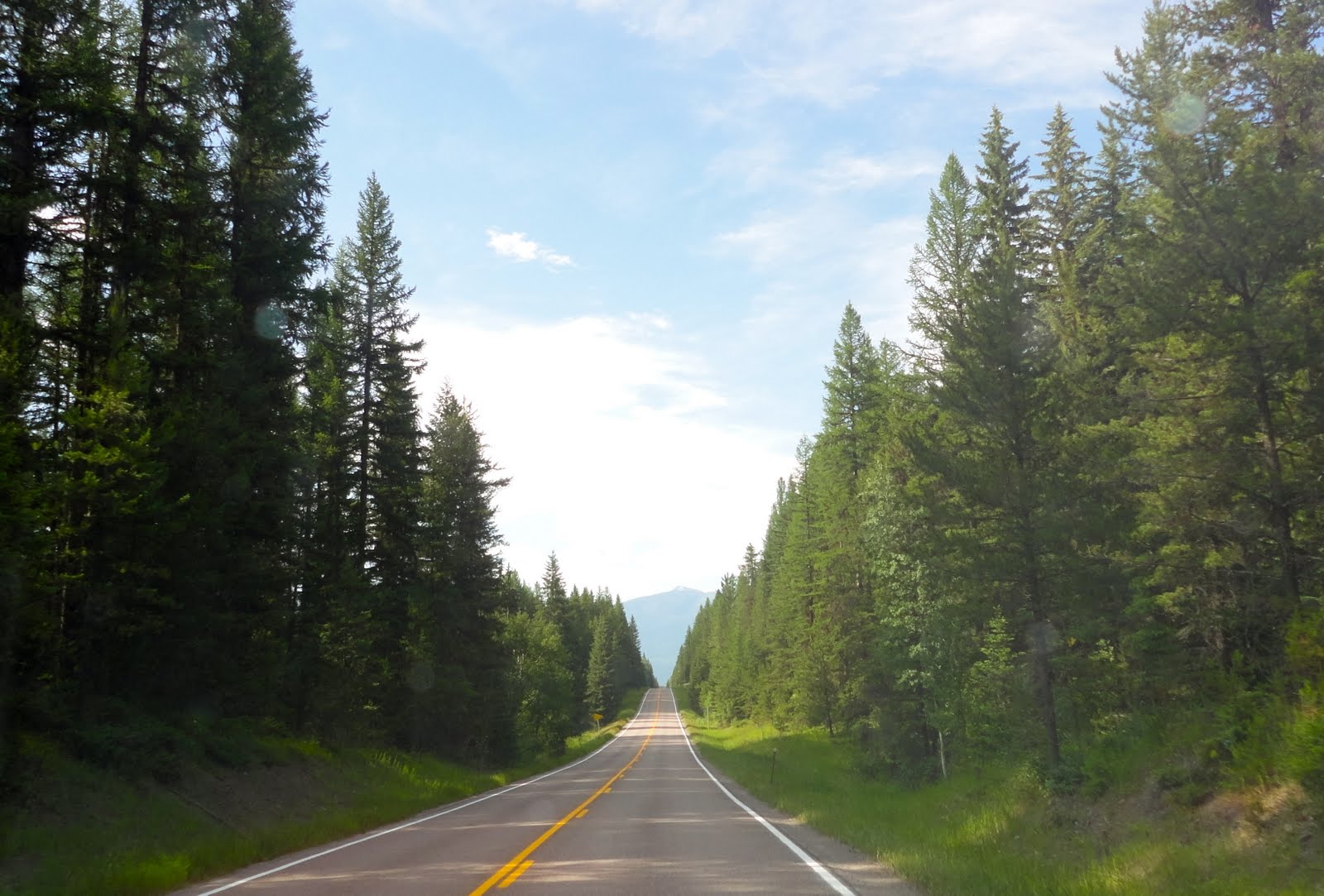
Driving through the mountains towards Whistler was an interesting (and sometimes scary) experience. The road is a two-lane road with hairpin turns - climbing and descending thousands of feet through miles and miles of mountain terrain.
Making our way through the terrain...

Our campsite in Whistler was on a mountaintop with spectacular views. Mark was in his glory having his morning coffee while overlooking the natural wonder.
Morning Joe : )
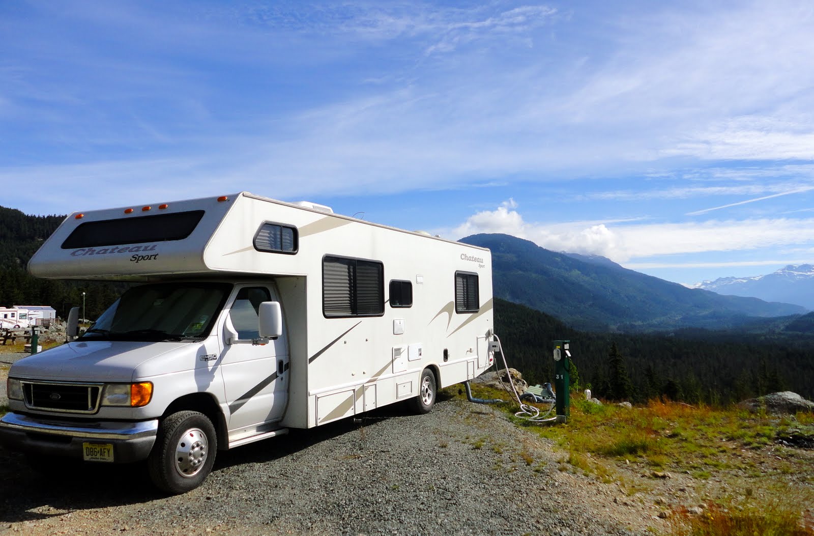
Nellie Belle on the mountaintop.
Whistler, Canada

We decided to drive through Vancouver since we had been there two years ago and were eager to get back into the USA. Since Victoria, British Columbia was on our itinerary we stayed in a sleepy town in northwest Washington, Anacortes. Once again, we were pleasantly surprised when we realized that our campsite was hosting an Indian Inter-Tribal Canoe Journey of over 20 nations from British Columbia, Alaska, and Washington. It's an annual event to honor the canoe journeys of the past. The owners of the site were the Swinomish Tribe and members were kind enough to invite us to their celebration. 
Each tribe had original songs and dance routines that reflected their indigenous culture.
Tribe members create hats of woven cedar bark,
which are very common on the Northwest Coast. 
The female dancers wore ornate, blanket capes that represented their Indian Nation. 
The next day we hopped on a ferry and went to Victoria, British Columbia for the day. It was a mellow day for us - strolled through the city, ate lunch at a cafe built in 1898, walked some more, went back to the cafe for coffee and dessert (of course), and called it a day.
Street artist using chalk...amazing!
Victoria, the capital of British Columbia

An authentic totem pole from a Canadian Indian Nation.

Our next destination is Seattle and then off to Portland, Oregon to spend a few days with our beloved friends, Alan and Kelly Melnick.

Ciao' for now  ; )


Saturday, July 23, 2011

Lake Louise, Banff National Park


Well, that's just great...
I have been with my husband for nearly six years and during that time I have never seen him as disappointed as he was when we were in Lake Louise. After we left the town of Banff, we drove about 75 kilometers to one of his lifelong destinations. This is an area that is the heart of Banff National Park and the most scenic area in the Canadian Rockies. The day we arrived, Mother Nature was not agreeing with our plan to hike – there was a constant, cold rain, and a cloud cover blocking the view of all the mountaintops. Hmm…what do we do now? We tried to make the best of it and drove west to see a few tourist sites we would not have sought out otherwise: a waterfall, a spiral train track – not fun when it’s raining. We wound up 45 minutes away from Lake Louise and decided to camp the night and hoped for better weather the next day. We stayed in a rustic, National Park campsite (only $17). No amenities, but incredible scenery. We were nestled in a valley and our “backyard” was a raging river with a backdrop of incredible glacier covered peaks. Mark set up our two beach-chairs, I made cups of tea, and we sat to admire the beauty of it all. 


At our campsite someone built an Inuksuit, which is a very popular symbol in Canada.
You see them along roads, on trails, and near lakes.
Years ago, the Inuit Tribe used them as trail markers in the deep woods.
You may recall that this was also the logo for the 2010 Olympic Winter Games.

In the morning, we awoke to cloudy skies, but no rain, and quickly packed up and headed back to Lake Louise. There are multiple trails – easy, moderate, and difficult. We opted for a moderate hike, the Six Pillar Glacier Trail, a five-mile (roundtrip) trek along the shore of Lake Louise, ascending on rocky paths to amazing views of the glaciers, and to the final destination at the top, a teahouse chalet, built in the late 1800’s. 
A little drizzle won't stop us.
The rain subsides!
Looking back to the lake where we started.

As we approached the glacier the temperature dropped.
Happy hikers!
After hiking for nearly two hours, we ate at the teahouse – veggie soup and tea biscuits for me, chocolate cake and coffee for Mark. $28.00 and so worth it. Interestingly, the women that work there live in cabins for five-day shifts since it’s so remote and the bulk of supplies have to be transported by helicopter. 
Yum.
Descending back to the base of the trail was much easier (although the drizzle was intermittent) and we were eager to get back to Nellie Belle, our two kitties, and back on the road. 
At this point, my legs are aching!
A half a mile to go until the trail ends.
There is a distinct area where you can see the silt and other minerals from
the glacier settling to the bottom before it reaches the lake.
A gorgeous lake. A great hike.
Our next destination is Vancouver with a few detours along the way ; )

Ciao’ for now.

Thursday, July 21, 2011

Banff National Park, Canada

Canmore, Canada - the coolest ice cream shoppe!
Leaving Calgary, we took Route 1 West towards Banff National Park, stopped at a charming little town, Canmore and then to the Town of Banff for two nights at a campsite in the park. Awesome.

Downtown Banff
Banff is a tourist gateway to the Canadian Rockies – a bustling little town with shops and restaurants. The location is idyllic with incredible snow covered peaks surrounding the entire village.

We ventured to one of the most popular hiking trails in the park: Johnston’s Canyon. It was a bit unnerving driving there (on our scooter) since we saw multiple signs warning us of wildlife. Although we did not see any wolves, we saw huge elks grazing on the side of the road, completely unfazed by the human beings in their personal territory.
Thank you, Park Rangers, for providing this menacing image of a wolf.


One of six elk we encountered (not too closely though).


The hike was approximately three miles and featured catwalks that were built into the side of the canyon overlooking rushing rapids and waterfalls.
Mark on the trail.
An aerial shot of the rapids.
Breathe deep and you can smell the pine.
The end of the trail was a 40 foot waterfall.
Gorgeous limestone.
Heading back to the trail entrance.
We stopped at the base of the mountain to take this photo. Yes, the water is that blue. 
Mark wanted you to see my "riding outfit." Considering what happened in Duluth on the 4th of July, I am always prepared for inclement weather when we ride!


Our next destination is Lake Louise, in Banff National Park.
Ciao' for now : )


Alberta, Canada: from a Chinook to the Calgary Stampede

After departing Montana, we traveled back into Canada, entering the province of Alberta.  Driving through Waterton Lakes National Park, we soon realized it’s an area less traveled – few cars and we had to stop for cows to cross the road - pure natural wilderness. 
This was taken right after passing through Customs, into Canada.
We're smiling now, but wait until we camp tonight...
 The township of Crow’s Nest Pass includes the mining town of Frank and here is where we experienced an eerie feeling. Unbeknownst to us, in 1903, there was a major limestone landslide that completely demolished the town. The remnants of the landslide are evident as you drive through town.
Over 600 people died from the landslide - the town was destroyed.
 We needed to camp for the night since we were heading to Calgary the next day, so we decided to stay in Crow’s Nest Pass. Big mistake. Little did we know that this particular area experiences Canadian Chinooks, which is a weather phenomenon caused by warm Pacific winds hitting against the Rocky Mountains and then dropping and swirling, causing severe high speed, warm winds over the prairies, including our campground. We happen to be camping on a night when a Chinook hit. No fun. At all. Needless to say, we were eager to get on the road and head towards Calgary.

Calgary is a sizable city with 1 million+ - very cosmopolitan, but a cowboy town, as well. We stumbled upon one of the biggest events for Canada, the Calgary Stampede. It’s been an annual event for over 100 years. It runs ten days and consists of a the highest purse rodeo in the West, championship chuck-wagon races, high-end Western entertainment and music and a huge carnival-esque atmosphere with food vendors, side-shows and stands for all of your cowboy/cowgirl paraphernalia.  

This photo doesn't quite capture how immense the event is. There are thousands of spectators...99% with their cowboy hats on.
Gorgeous Clydesdale horses.
The chuck-wagon races.
The evening show was a mixture of Broadway and Cirque de Soleil.
The show was great and the finale had one of the best fireworks shows we have EVER seen. 
Our next destination is Banff National Park.
Ciao' for now : )

Thursday, July 14, 2011

Waterton-Glacier International Peace Park (Glacier National Park)


Heading to our campsite near Glacier National Park.

Looking at a map, the Waterton-Glacier International Peace Park is unique - it's cooperatively managed between the U.S. and Canada. The majority of the park is in Montana, the upper, western portion is in the providence of British Columbia, and the eastern portion in in the providence of Alberta. Since 1932, this union has been recognized for its "bonds of peace and friendship between the two nations."


Unfortunately, we couldn't take the motor-home into the heart of the park, so we hopped on a shuttle and headed for Avalanche Lake. The trail to the lake was a two-mile ascension (500 feet) and was packed with huge ancient cedars and rushing rapids.

As we walked along the side of the rapids, the temperature dropped substantially.
While we walked, we clapped our hands, snapped our fingers, and talked (and sang) loudly to scare any bears away. It worked - we didn't see any. Maybe it was my singing ; )
We arrive at Avalanche Lake.
Majestic + tranquil

Happy campers!
Why the trail and lake are called AVALANCHE!
We met two young men from Australia who purchased Bear Pepper Spray since they were planning to hike deep in the park. No thank you. Scary thought.
We took another shuttle to Logan Pass, a sub-alpine terrain of over 6,600 feet.
The trip was 16 miles long and took nearly an hour to reach the top.
The roadway (two, narrow lanes) was treacherous.
We were in awe as we continued to drive.
These rocks are the barriers on the side of the road?!!?
The temperature dropped dramatically as we ascended.
July 13, 2011 @ Logan Pass
Next stop is Alberta, Canada. More to come.
Ciao' for now.